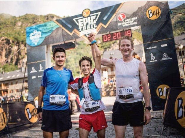
Jo Forseth Indgaard krydrer sommertreninga med forskjellige utfordringer. I dag løp han Buff Epic Trail i Catalonia. Den 21 km lange løypa hadde start og mål på 1096 moh. Og opp til løypas høyeste punkt på 2619 moh gikk det rett så bra, som han selv sier. Men i nedstigningene til mål ble han innhentet av en løper. Likevel, andreplass i dette krevende løpet er mer enn godkjent.

The race starts in Barruera and climbs towards the village of Erill la Vall,
with the first kilometer of the course running along a narrow trail that forces runners to fall into place before leading to a fast trail to Erill. With its extremely slight grade this section of the race can be run very quickly.
These first kilometers share the course with the Ultra race, but the half marathon continues along the Camí de l’Aigua along a shady path to the intersection with the Montanyeta valley, where the trail begins a fairly straight 500-meter climb with uneven terrain through the forest. At the end of this climb runners will find themselves at the top of valley and will enter high-mountain terrain at 2,000 meters above sea level, running along the Comaminyana valley to the peak of the same name, at 2,619 meters the highest point of the race with spectacular views of the Barrabés, Boí and Sant Nicolau valleys, and famous mountains like Bessiberris, which it feels like you can touch, Punta Alta and Aneto; and, of course, the summit of Roies de Cardet, site of the popular “Vertical Kilometer” race.
The course continues from the top of Comaminyana along an open ridge that boasts the same outstanding views, descending to Port de la Gelada (once again along the same course as the Ultra). The trail then continues downhill through high-mountain meadows and an open valley, passing by the Sant Salvador hermitage, and ends back in Barruera, where you pass through the village to reach the finish line.
Only two sections of the course are on asphalt: through the village of Erill and at the entrance to Barruera. The rest of the race is ALL run on trails and high-mountain areas, at times without any trails or paths.

